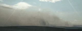
Webcam view of the start of the Bárðarbunga volcanic eruption.
The activity seems to be occurring in several places, with that part that is under the ice not being visible, were it be occurring, though if it breaks through the ice then this is where the larger plumes might be generated.

Earthquakes around the site (Icelandic Met Office)
The condition has been changed to RED, with the Met Office reporting that there are 150 to 400 m of ice above the surface in the region of maximum activity, and it will take some time for the magma to burn through this to the point where it ruptures, if it is big enough to do so. However the latest earthquakes include one of over 4.5 which is quite a bit bigger than earlier ones.
This has been UPDATED on 24 August.
The activity is continuing to grow.

Later on the 23rd. (Icelandic Met Office via Jón Frímann)
The eruption is definitely occurring along a rift in the rock. The development can be seen from a picture of the developing earthquakes from the 16th August, as Jón Frímann shows.

Development of the eruption as the magma moves along a rift to form a new dyke which is rising to the surface, prior to the eruption on the 16th August (Icelandic Met Office via Jón Frímann)
The growing potential size of the eruption can be seen from the latest picture of the earthquake activity, with it spreading away from the caldera.

Overview of Iceland showing the increasing scope of the activity on 24 Aug. (Icelandic Met Office)
The dyke is reported to be 40 km long already, and the magma, outside the ice cap may likely flow without much of it generating the high clouds of ash that are a threat to aircraft, and future weather patterns in Europe. (These eruptions can last some time). However if the bit under the icecap breaks through then the combination of water turning to steam and thermal shock on the rock can generate the very small particles which become a threat to both.


